10+ Best Lake Atitlán Hikes & Trails From Easy to Expert

Everything you need to know about the best hiking trails in Lake Atitlán, from challenging volcano treks to easy waterfall walks and nature reserves.

This post may contain affiliate links, which means we might earn a small commission on anything purchased through these links at no extra cost to you. Learn more on our disclaimer page.
Lake Atitlán is ringed by steep volcanic slopes, forested ridgelines, and centuries-old footpaths that connect indigenous villages, perfect for hiking, but not all trails are equal. From daunting volcano summits and multi-day treks to village-to-village routes and lesser-known viewpoints, it’s easy to underestimate the difficulty, safety considerations, or logistics involved when hiking in Lake Atitlán.
We researched and explored hiking options around Lake Atitlán for our trip to Guatemala to find the best trails around the lake, from popular volcano climbs to shorter scenic trails. Some are easy peasy, while others require early starts, guides, or realistic expectations about fitness levels and terrain.
Discover the best hiking trails around Lake Atitlán, including distances, difficulty levels, safety considerations, and how to organise each one – whether independently or as part of a group hiking tour – in this guide.

More from Lake Atitlán
Hiking around Lake Atitlán
There are several hiking routes around Lake Atitlán that offer views over the water, volcanoes, and villages. Trails range from short walks to full-day treks. Many paths start from specific towns and wind through farmland, forests, and small villages before reaching viewpoints.
Hiking independently is possible, but for longer or quieter trails, a local guide is important. They know the safest routes and can point out shortcuts, viewpoints, and hidden features you’d otherwise miss. Some hikes aren’t recommended to do on your own for safety reasons (both geographic and historic crime), so arranging hikes with a guide is best.
The most important things to know are to start early, bring water, sun protection, and wear sturdy shoes. Afternoon clouds can roll in quickly, reducing visibility, and trails vary in quality – some are well-maintained, while others are narrow and overgrown.
Lake Atitlán Hiking Trails Map
Use the filter function on the left-hand side to see all the best trails in Lake Atitlán.
The best hikes in Lake Atitlán
Here are the best hiking trails around Lake Atitlán. Each trail has a difficulty rating based on the terrain, elevation gain, technicality, and overall effort required. Everyone’s experience is different, but these categories should give you a realistic idea of what to expect:
1. San Pedro Volcano
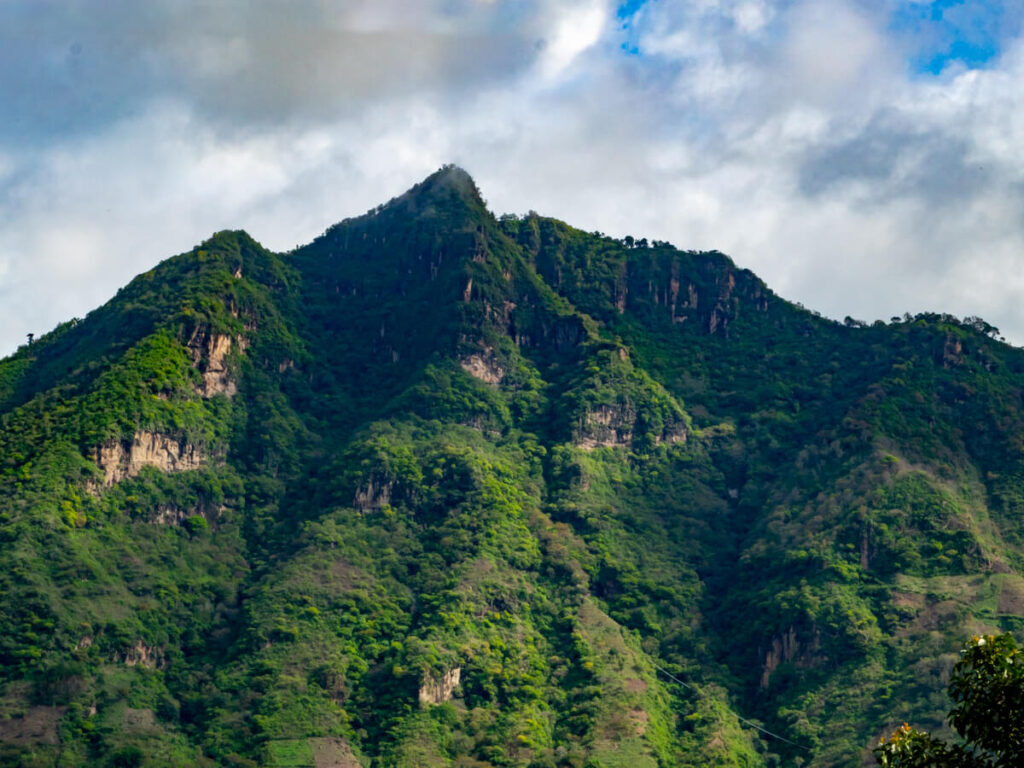
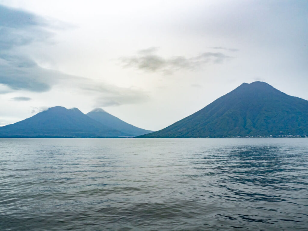
Lake Atitlán is framed by three volcanoes – San Pedro, Atitlán, and Tolimán – and all three can be climbed, making it one of the best places in Guatemala to visit for hikers. The lake attracts serious hikers who wish to scale these imposing slopes, but different villages make the best base for each hike.
San Pedro Volcano (Volcán San Pedro) is the easiest and most climbed of the three volcanoes. It’s a dormant stratovolcano, meaning it was built from layers of lava, ash, and volcanic rock over thousands of years, with a symmetrical cone that gives it that iconic volcano look from across the lake.
You start at the trailhead near San Pedro La Laguna at around 1,800 metres (5,900 ft) above sea level. Access is community-managed, and there’s a small fee to be paid at the entrance. The hike is pretty much uphill the whole way, so you climb constantly to the summit at 3,020 metres (9,908 ft). From the top, you can look across the lake toward Atitlán and Tolimán volcanoes, with the Pacific coastal plain visible on very clear days.
The lower section passes through coffee plantations before transitioning into a humid cloud forest. The terrain is steep dirt, often loose and muddy in the rainy season (May-October), so proper hiking shoes with good grip are essential.
Cloud cover frequently rolls in late morning, so it’s important to start early for the best weather conditions and views across the lake. It takes around 2-4 hours to scale to the summit, depending on your pace, and slightly less time on the descent.
In recent years, the volcano hikes have been hotspots for robberies and hiking alone has not been recommended. Increased police presence has improved the situation, but it’s still advisable to go with a local guide. You can check the current safety situation at the trailhead near San Pedro, where you pay the small entrance fee, or with your accommodation in Lake Atitlán.
This is the only volcano trail on Lake Atitlán you can hike independently, but even then, we’d still recommend booking onto a guided hike to be safer. You can arrange guided hikes of San Pedro Volcano with local operators, including:

2. Atitlán Volcano
Atitlán Volcano (Volcán Atitlán) is the tallest of the three lake volcanoes and the most physically demanding. The route typically begins at the trailhead above Santiago Atitlán at around 1,800 metres (5,900 ft) above sea level and ascends through coffee farms, farmland, and cloud forest before transitioning into sparse volcanic terrain near the top.
The upper sections are steep and eroded, with loose volcanic soil and exposed roots. There are no technical climbing sections, but endurance and solid footing are essential, as this is a full-day, high-elevation climb with sustained steep gradients.
You’ll trek for around 6-8 hours to the summit, at 3,535 metres (11,598 feet), where you can see the full expanse of Lake Atitlán, Tolimán Volcano directly beside you, and even Fuego Volcano smoking in the distance near Antigua on clear days.
Unlike San Pedro and Tolimán, Atitlán has had recorded historic eruptions, with its last known eruption occurring in the 19th century. At its highest point, you can see the remaining petrified lava from the 1853 eruption.
Because it’s one of Guatemala’s toughest hikes (a rival to the famous Acatenango Volcano hike), many tour operators spend the night at the summit, where you can camp on the side of the crater. You have to do this hike with a guide, and our top picks are:
3. Tolimán Volcano
Atitlán and Tolimán Volcanoes sit side-by-side and are often described as twins, forming at the same time during the supervolcanic eruption (Los Chocoyos eruption) around 84,000 years ago. Tolimán is the hardest and least hiked volcano of the three on Lake Atitlán.
The trail begins near the town of San Lucas Tolimán and climbs through private farmland before entering the forest. Because the town’s quite small, most guides operate out of the nearby Santiago Atitlán.
The ascent is steep, particularly in the final third. It takes about 4 hours to scale to the summit at 3,158 metres (10,361 ft). Tolimán is an inactive stratovolcano and actually has two peaks to the north and south, one of which has an imploded crater.
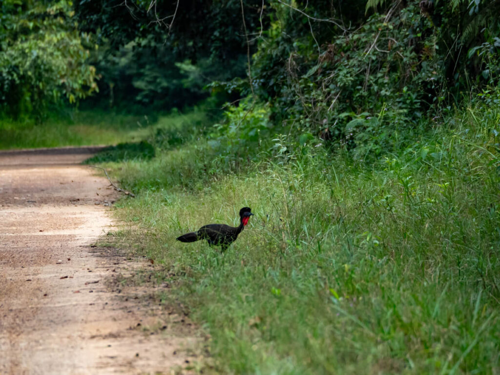
Unlike Atitlán Volcano, Tolimán’s summit is broader and less defined, with viewpoints slightly below the highest point offering the best lake panoramas. On your way, you’ll pass through dense cloud forest, where you might see birds like the horned guan (a rare species of turkey, locally known as a ‘pavo’).
As with the other major volcanoes, this is not a hike to attempt independently. Our top picks are:
4. The Indian Nose hike
The Indian Nose (Nariz de Indio), also called the Maya Face (El Rostro Maya), is probably the most famous hike in Lake Atitlán. The trails lead to an epic viewpoint over the lake, with tours typically departing around 3:30-4:00 AM from San Juan, San Pedro, and San Marcos to the Santa Clara trailhead.
It takes about 25-40 minutes one-way to climb the 0.8-mile (1.2 km) path to the viewpoint up a short but steep hill, where you’ll reach around 2,200 metres (7,218 ft) above sea level. You’ll be rewarded with one of the most dramatic views in Lake Atitlán, with all three volcanoes visible on clear days, and views down to nearby towns like San Juan, San Pedro, and San Marcos.
This hike is most similar to Antigua’s Pacaya Volcano, being short yet scenic, albeit not volcanic.
There’s a second trail from San Juan La Laguna, which actually follows the Mirador Kaqasiiwaan path (which is the next hike on this list) for the first section, before ascending a steep ridge covered in pine and eucalyptus. It’s much more difficult than the Santa Clara route, taking around 1.5-2 hours one-way and is very steep, so it’s not advisable without a guide.
These are our top Indian Nose hike tours:

5. Mirador Kaqasiiwaan
Also called the Mirador de San Juan La Laguna (San Juan Viewpoint), Mirador Kaqasiiwaan is a pretty easy hike and one of the best alternatives to El Rostro Maya if you want similar views without the 3:00 AM wake-up call.
The Mirador Kaqasiiwaan trailhead sits just outside the beautiful town of San Juan La Laguna and quickly climbs up over 300 steps to the top of a large hill, which is where its other name -Cerro de la Cruz (Hill of the Cross, not to be confused with Antigua’s Cerro de la Cruz) – comes from.
It takes about 20-30 minutes each way, depending on your pace and how comfortable you are climbing steps, but if you stop to catch your breath, you can admire the surrounding misty mountains.
At the top, you’ll find vendors selling refreshments, a couple of lakeview restaurants, and a large wooden observation deck that’s painted with colourful murals that represent elements of Maya life and culture. The deck is just as impressive as the view, which provides a panorama over the lake and neighbouring towns of San Pedro and San Marcos.

6. The Lower Mayan Trail
The Lower Mayan Trail is a scenic lakeside route that connects San Marcos to Tzununá, Jaibalito, and Santa Cruz along the west shore of Lake Atitlán. It follows traditional Kaqchikel Maya routes that have been used for centuries.
The full stretch from San Marcos to Santa Cruz is around 11.5 miles (18.5 km) one-way and takes around 6 hours, depending on your pace and how many stops you make. You can also split the Lower Mayan Trail into sections for shorter hikes. The route can be walked in round-trip sections (the stretch between Santa Cruz and Tzununá is prettiest), or you can do the whole route one-way and take a boat back, with plenty of cafés and small eateries along the way.
The walk winds through farmland, jungle patches, and riverside sections, and is pretty gentle, with occasional hills and uneven terrain. You’ll pass houses, schools, and local markets, giving a real glimpse into everyday Maya life around the lake.
Security issues like robberies have been reported on this route in the past, but many people have hiked it trouble-free. It’s best to go with a guide if you’re nervous or not used to the area:
Los Elementos Adventure Center also offers guided hikes along the Upper Mayan Trail, which connects Santa Cruz and Panajachel to the highland town of Sololá.
7. Xela to Lake Atitlán
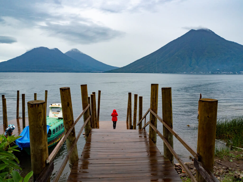
While not technically in Lake Atitlán, trekking from Quetzaltenango (Xela) to the lake is one of the most popular things to do in Guatemala.
It’s a long, 3-day hike that starts in pine forests and climbs through cloud forest patches, passing through small villages, where you stay overnight with remote Maya communities, until you reach the El Rostro Maya for sunrise. It’s the most unique way to get to Lake Atitlán for sure.
Quetzaltrekkers is the most well-known operator that runs the route. As a local NGO, they have a strong focus on community and environmental initiatives, partnering with nearby villages to ensure the benefits of tourism stay local, support school and conservation projects along the trail, and emphasise low-impact trekking to preserve the fragile ecosystems they pass through.

8. Cerro Tzankujil Nature Reserve
If you’re not keen on doing any mega hikes, then taking a short walk in a nature reserve is perfect. Cerro Tzankujil Nature Reserve (Reserva Natural Cerro Tzankujil) is a protected lakeside reserve in San Marcos La Laguna and one of the easiest hikes around Lake Atitlán.
The reserve contains a short network of interconnected trails that takes around 1-2 hours to explore fully. You’ll wind through low forest and along rocky outcrops with multiple viewpoints over the lake. The terrain consists of dirt paths, wooden steps, and exposed rock near the water. There’s a small entrance fee to pay at the gate near the dock.
Bring your swimwear, because Cerro Tzankujil is one of the best places to swim in Lake Atitlán. It’s particularly known for its cliff-jumping platforms built into the volcanic rock, the tallest of which is 12 metres (40 ft) tall and one of the best things to do in Lake Atitlán.

9. Atitlán Nature Reserve
Atitlán Nature Reserve (Reserva Natural Atitlán) is located just outside Panajachel, about a 10-minute tuk-tuk ride from the centre of town. A private reserve, it’s a serene place to go for a walk in nature, with marked trails through forest, lakeside cliffs, and even suspension bridges like Costa Rica’s hanging bridges.
The paths vary from short loops to longer routes that explore deeper into the jungle in the San Buenaventura Valley. Guatemalan wildlife is abundant, and you might spot birds, monkeys, coatis, and butterflies along the way. Some trails pass waterfalls or hidden viewpoints, too. This is one of the most accessible short hikes around Lake Atitlán and doesn’t require a guide.

10. Tepepul Nature Reserve
Tepepul Nature Reserve (Reserva Natural Tepepul) sits on the slopes above Santiago Atitlán, on the southern side of Lake Atitlán. It protects a large area of cloud forest on the lower flanks of Atitlán Volcano and is one of the best places around the lake for birdwatching.
There are multiple trail options within the reserve, typically taking 2-4 hours depending on the route you choose. Trails climb steadily through pine and mixed forest, with viewpoints like Mirador Rey Tepepul Reserva Natural de Atitlán overlooking the lake and the surrounding volcanoes.
Unlike the exposed volcano hikes, Tepepul is heavily forested, so this isn’t a summit-view kind of hike. But it has great biodiversity. The reserve is known as a habitat for the resplendent quetzal, Guatemala’s national bird, which inhabits high-elevation cloud forests like this one. Other bird species recorded in the area include toucanets, motmots, and various hummingbirds.
Sightings are never guaranteed, but early morning is the best time to visit, particularly during the breeding season (typically March-June), when males are more active. We learned how elusive these birds are when we saw a quetzal in Costa Rica (after 1.5 hours of waiting), so go with a local guide for the best chance of seeing one.

Other hikes in Lake Atitlán
If you’ve had your fill of swimming directly in the lake, there are a handful of smaller hikes around the basin that lead to waterfalls, hidden beaches, and unusual volcanic formations. None are as demanding as the volcano ascents, but they’re worth adding to your Guatemala itinerary if you want something different.
Waterfall hikes in Lake Atitlán
Playa la Finca
Playa La Finca is one of the few small lake beach areas, located just outside San Pedro, on the western side of Lake Atitlán. It’s reached on foot via a trail that takes roughly 1 hour out-and-back, depending on your pace.
The Playa la Finca trailhead starts by a basketball court on the very edge of town – you can take a tuk-tuk to it to save walking the whole way. At the lake’s shore, you’ll find a black sand beach, which is a popular gathering spot for local families on a weekend.
Unlike the cliff-jumping platforms in San Marcos, Playa La Finca offers gradual lake access from a pebbled shoreline, making it one of the more relaxed swimming spots near San Pedro.
Cerro de Oro
Cerro de Oro (which translates to the Golden Hill, but it’s also called the Sleeping Elephant) is a distinctive parasitic lava dome located on the southern side of Lake Atitlán. It was formed on Tolimán Volcano‘s northern flank and offers panoramic views over the lake.
The hike to the top takes around 2-3 hours round-trip, depending on your starting point and pace – you can start in either Santiago Atitlán. The trail climbs steadily through farmland and forest, with some steep dirt sections near the top.
From the summit, you get a unique perspective across the lake basin. Birding Atitlan Expeditions offers a guided hike here.

Tips for hiking around Lake Atitlán
There’s always a risk when hiking outdoors. Stay safe on your hike by following the tips below:

What to pack to hike around Lake Atitlán
There are some obvious things you’ll want to pack for hiking in Lake Atitlán. We’ve compiled a list to make sure you don’t forget the essentials:

Hiking in Lake Atitlán FAQs
Now that you know the best hikes in Lake Atitlán, we’re going to finish with a few frequently asked questions to ensure you’re fully prepared for your visit.
Can you walk around Lake Atitlán?
Lake Atitlán is perfect for hiking, with multiple trails ranging from easy to challenging. You can’t realistically walk all the way around Lake Atitlán, as the shoreline is broken up by steep cliffs, private land, and long stretches without proper paths. But you can walk sections of it, with the Lower Mayan Trail being the most popular route and another route between Santa Catarina Palopó and San Antonio Palopó.
What Lake Atitlan hike has the best view?
The Lake Atitlán hike with the best views is widely considered to be the Indian Nose viewpoint (also known as El Rostro Maya). From the top, you get panoramic views of the lake framed by volcanoes, especially at sunrise, which is most popular. It’s a relatively short hike with a big reward.
What is the best volcano to hike in Lake Atitlán?
The best volcano to hike in Lake Atitlán for most travellers is Volcán San Pedro. It’s challenging but manageable in a half day and offers sweeping views across the lake from the summit. For something more demanding and less trafficked, Volcán Tolimán is another option, though it requires more time and preparation.
Is it safe to hike around Lake Atitlán?
It is generally safe to hike around Lake Atitlán, but using a local guide is recommended for longer routes and volcano climbs. Some trails have had reports of petty theft in the past, and weather conditions can change quickly. Starting early, going with others, and checking local advice before setting out are sensible precautions.
What is the best time to hike in Lake Atitlán?
The best time to visit Guatemala to hike in Lake Atitlán is early in the morning, especially during the dry season (November to April). Mornings tend to have clearer skies, cooler temperatures, and better visibility before clouds roll in during the afternoon.

Read next:
A Traveller’s Guide to Lake Atitlán: Itinerary & Essential Travel Information
Where to Stay in Lake Atitlán: 12 Towns & Top Hotels
25 Amazing Things to Do on Lake Atitlán
How to Get to Lake Atitlán & Getting Around by Boat + More
A Complete Guide to San Juan La Laguna: Lake Atitlán’s Artistic Town
A Succinct Guide to San Pedro La Laguna: Lake Atitlán’s Backpacker Town
A Short Guide to San Marcos La Laguna: Lake Atitlán’s Hippie Town
How to Hike to Mirador Kaqasiiwaan & El Rostro Maya (Indian Nose)
Our Eco-Hotel MayAchik’ Review: Sustainable Hotel in Lake Atitlán
Our Guatemala Destination Guides:
Our Guatemala Travel Guides:
