12 Best Hikes in Durmitor National Park From Easy to Expert

Discover everything you need to know about hiking in Durmitor National Park, including the top trails from easy to expert and how to stay safe.

This post may contain affiliate links, which means we might earn a small commission on anything purchased through these links at no extra cost to you. Learn more on our disclaimer page.
If there’s one reason to visit Durmitor National Park, it’s the hiking. With more than 40 peaks over 2,000 metres, dramatic limestone ridges, alpine meadows, and panoramic viewpoints, it’s one of the best hiking destinations in Montenegro – and the Balkans at that.
We planned our entire Montenegro trip around hiking in Durmitor National Park, and it didn’t disappoint. We tackled a mix of the park’s most popular and lesser-known trails, and quickly realised there’s much more to it than the famous hike to Bobotov Kuk. Whether you’re after an easy stroll around a glacial lake or a full-day climb to one of Montenegro’s highest peaks, Durmitor has trails for every experience level.
But choosing the right hike isn’t always straightforward. Trail difficulty is often underestimated online, conditions can change quickly in the mountains, and not every route is suitable for every hiker. Knowing what to expect before you set off can make the difference between a memorable day in the mountains and a miserable one.
In this guide, we’ve rounded up the best hikes in Durmitor National Park, from gentle family-friendly walks to challenging summit climbs, with practical information on difficulty, distance, trailheads, parking, highlights, and who each trail is best suited to.

More from Durmitor National Park
Where to hike in Durmitor National Park?
Durmitor National Park is one of the best places to hike in Montenegro, with everything from easy lakeside walks to demanding summit routes. The park’s landscape is incredibly varied, with glacier-carved valleys, dense pine forests, high alpine meadows, and dramatic limestone peaks creating a different experience on almost every trail.
Most hikers base themselves in Žabljak, the small mountain town located just outside the park, as it provides the easiest access to many of the main trailheads. From here, you can reach famous routes like the Black Lake, Ćurevac, Savin Kuk, Prutaš, and Bobotov Kuk, while quieter trails lead deeper into Durmitor’s remote valleys and glacial lakes.
Hiking in Durmitor National Park becomes surprisingly complicated once you realise just how many ways the network of trails can be connected. Many routes overlap, share sections of the same path, or can be extended into longer adventures depending on your fitness, experience, and how much time you have.
For each hike, we’ve focused on the most commonly followed route, highlighting the main trailhead, any alternative starting points, and the key details you’ll need to plan your day, like parking areas, distances, elevation gain, estimated hiking times, and what to expect along the way.
Each trail has a difficulty rating based on the terrain, elevation gain, technicality, and overall effort required. Everyone’s experience is different, but these categories should give you a realistic idea of what to expect:
Durmitor National Park Hiking Tours
While most of the park’s trails can be completed independently, a guided Durmitor National Park hiking tour can be a great option if you’re short on time, unfamiliar with mountain hiking, or simply want to learn more about the park’s geology, wildlife, and history. Local guides also know the latest trail conditions and can tailor routes to suit your experience level, which is ideal if it’s your first time in Durmitor National Park.

Durmitor National Park Hiking Map
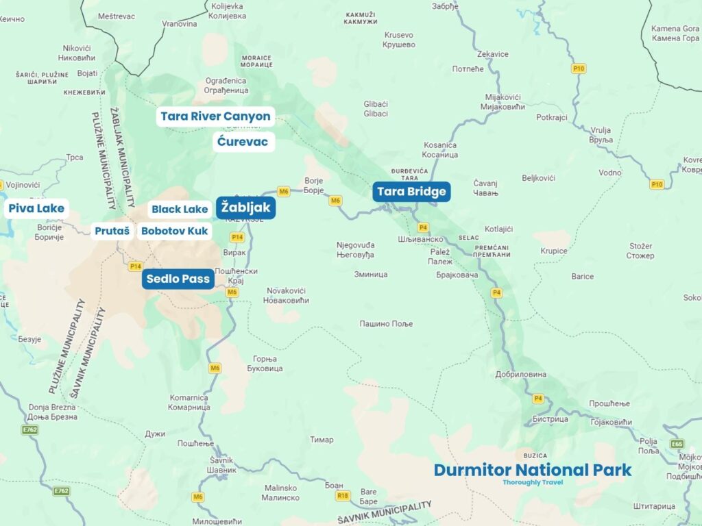
Most of the best hiking trails in Durmitor National Park are located along Sedlo Pass, around the Black Lake, and in the north along the Tara River Canyon.
Easy Hikes in Durmitor National Park
While Durmitor National Park is famous for challenging mountain routes, it’s also home to plenty of shorter walks that allow you to experience its landscapes without committing to a full-day summit climb. From peaceful glacial lakes to canyon viewpoints, these easier trails showcase the diversity of Durmitor’s scenery.
1. Black Lake
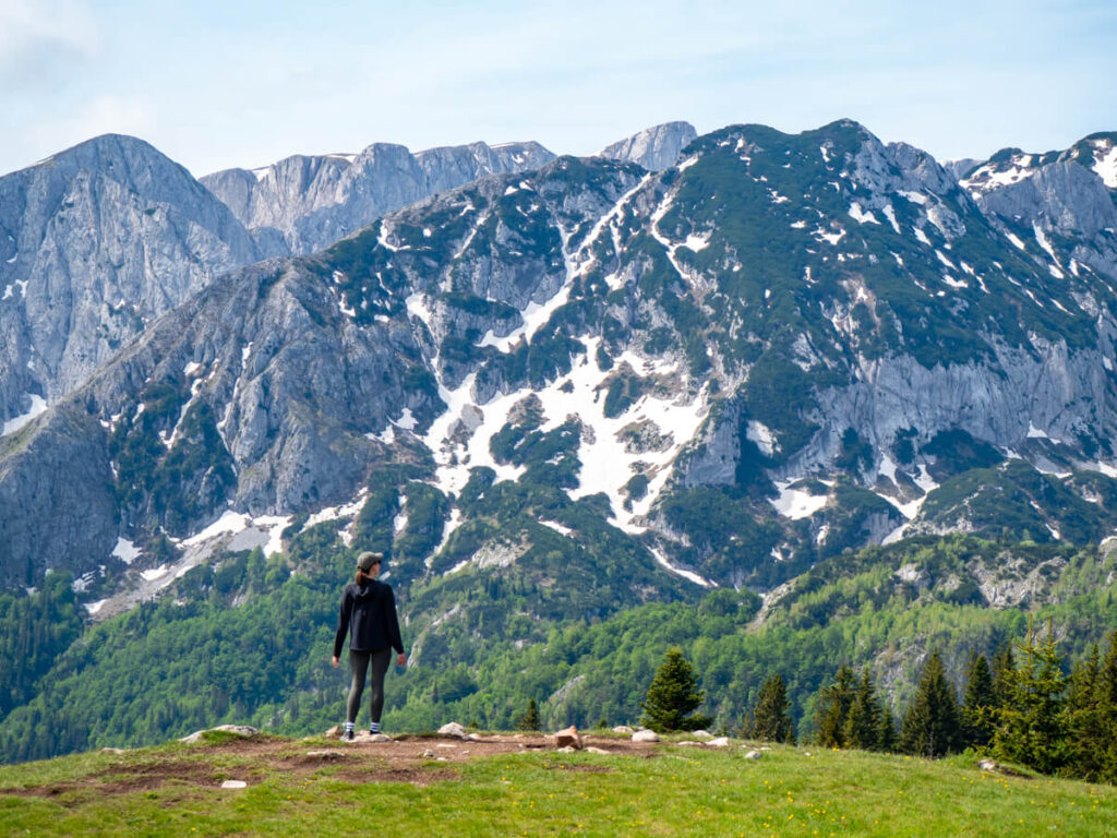
The Black Lake (Crno Jezero) is one of the most famous things to do in Durmitor National Park, and a great introduction to Montenegro’s mountain landscapes. Located just 1.9 miles (3 km) from Žabljak at an elevation of 1,416 metres (4,646 ft), this glacial lake is surrounded by dense black pine forest and the dramatic limestone peaks of Mount Međed.
The name can be slightly misleading, as the water itself is not black. Instead, the lake gets its name from the dark reflections created by the surrounding forests and the depth of the water. Locally, it is one of Durmitor’s famous “Mountain Eyes” (Gorske Oči), a nickname given to the park’s 18 glacial lakes because they appear like bright blue and green eyes scattered across the mountains.
One of the most interesting things about Black Lake is that it is actually made up of two connected lakes: Veliko Jezero (Big Lake) and Malo Jezero (Small Lake).
A simple circular trail follows the shoreline of the Black Lake through the forest of tall pine, spruce, and conifer trees. It’s pretty flat and easy to follow, with a couple of small boardwalk sections and little bridges.
Elevation gain is minimal, although there are a couple of small hills and a stone staircase. In early June when we visited, we also needed to cross a small waterfall – during snowmelt and wet periods, parts of the path can flood. These little challenges may take the hike from easy to moderate for you, depending on your fitness and ability.
The Black Lake loop is a great walk in Durmitor National Park for families and anyone who loves nature and is keen for a trail that doesn’t require difficult mountain climbing.
Longer routes
The Black Lake can be combined with two more lakes, Zminje (Snake) Lake and Barno Lake, to create a longer loop around the trio.
It is also the springboard for longer routes into Durmitor National Park, including the trail that leads to the Ice Cave (Ledena Pećina), Obla Glava Peak, Planinica Peak, and Bobotov Kuk Peak.
2. Devil’s Lake
Despite its dramatic name, the Devil’s Lake (Vražje Jezero) is one of the most peaceful places in Durmitor National Park. Located around 7 miles (11 km) from Žabljak, this glacial lake gets its name from local folklore, as stories and legends tell of devils, spirits, and strange events happening there.
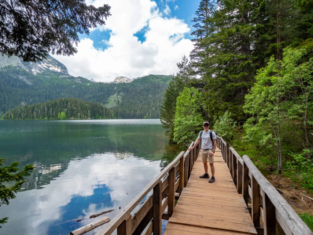
Unlike the Black Lake, which is enclosed by thick forest and towering peaks, Devil’s Lake has a much more open landscape. The lake itself is surrounded by open grasslands and distant views of mountain scenery at Savin Kuk.
The best way to appreciate Devil’s Lake is from above, and a short trail leads up a nearby hill for aerial views, where you can see the turquoise water stretch across the valley. Uniquely, it has a much deeper centre, where the dark blue contrasts with the azure shallow outer edges, creating an effect that looks like an eye.
The total distance and elevation depend on where you park and how high up the hill you go. It takes about 10 minutes to climb to the top. We’d consider it easy, but beware that the very top requires a little scramble up some rocks, which we’d class as moderate. You can still see the views without doing it, though, so if you don’t mind a hill, the actual walk itself is easy.
This is a great place to slow down and enjoy a picnic. Often, paddleboard hire is available from the small hut at the top end of the lake.
The Devil’s Lake is also less than a mile from another lake, Fish Lake (Riblje Jezero), and 12th-16th century stećci, carved tombstones that form a Medieval Slavic Cemetery.
3. Valovito Lake
Valovito Lake (Valovito Jezero) lies near one of the main entrances to Durmitor National Park along the P14. The trailhead leaves from a parking area that’s also a popular sunset spot.
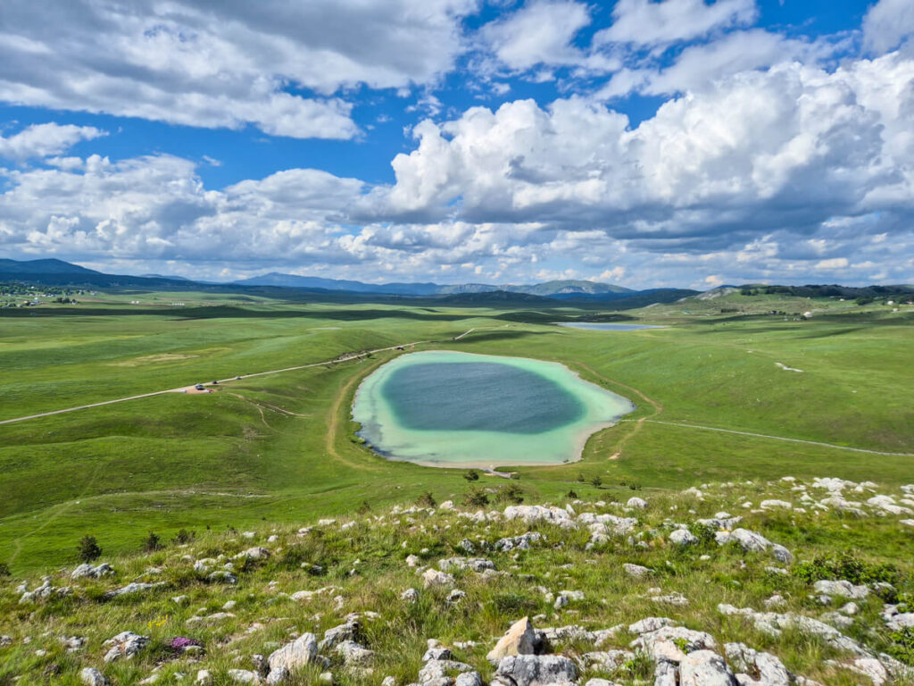
It’s pretty easy to go out-and-back to Valovito Lake, which sits in the Pošćenska Dolina Valley, beneath the impressive limestone peaks of the central Durmitor massif.
The lake sits at an elevation of approximately 1,695 metres (5,561 ft) and occupies a classic glacial basin, surrounded by rocky slopes, alpine grassland, and seasonal wildflowers. Like many of Durmitor’s lakes, its water level varies throughout the year, with spring snowmelt usually producing the most impressive conditions.
Longer routes
It’s uncommon to just go out-and-back. Rather, the official route does a full loop that also passes a couple of other lakes in the valley, including Modro Jezero and Suva Lokva.
4. Savin Kuk
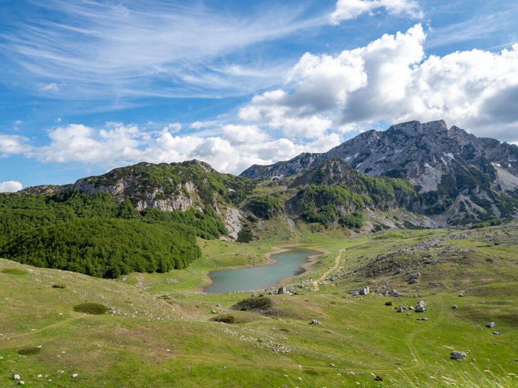
Rising to 2,313 metres (7,589 ft) above sea level, Savin Kuk is one of Durmitor National Park’s most accessible peaks. Named after Saint Sava (Sveti Sava), Savin Kuk is also home to Durmitor’s main ski area during winter.
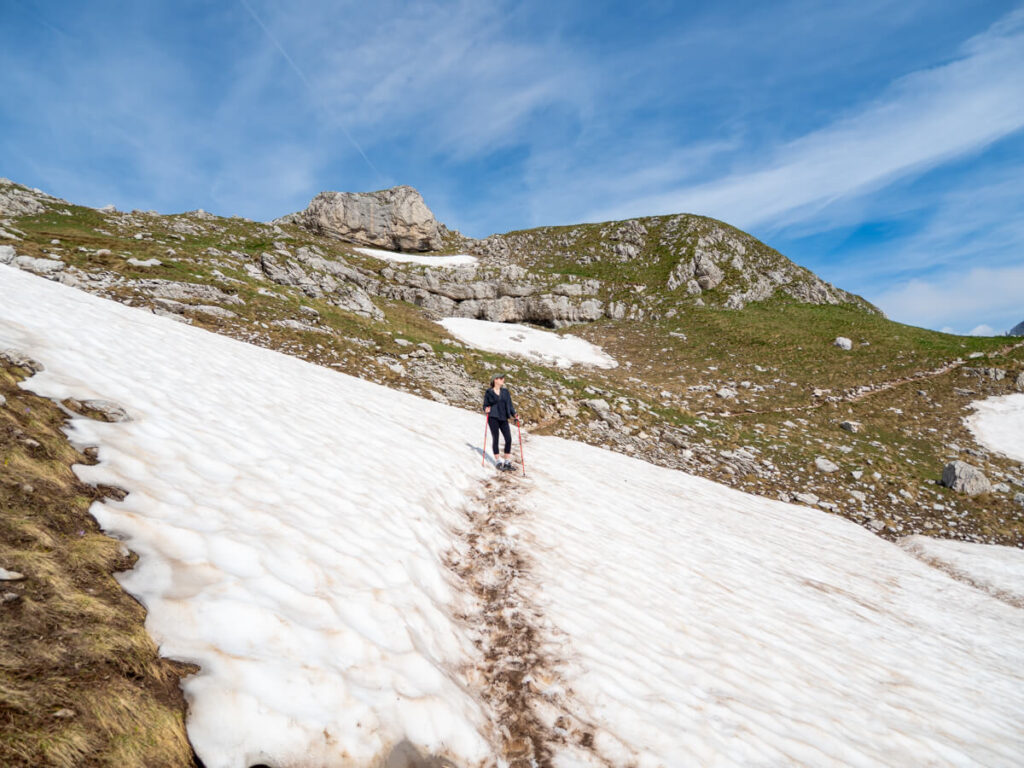
The whole trail can be tackled from the base at the Savin Kuk Ski Center, taking around 5 hours return to climb ~780 metres (2,560 ft) along the 5.2 miles (8.5 km) trail out and back. It’s difficult, and a lot of the path is impassable due to snow, even into mid-June.
The reason we’ve included this in the easy hikes section is that you don’t actually need to do most of the hike to reach the summit. You can take a series of ski lifts up the mountain to the Lower station at around 1,516 metres (4,975 ft) and the Upper station at 2,213 metres (7,260 ft) high.
From there, it’s a much shorter and less steep hike to the summit via a series of gentle switchbacks. From the top, you’ll be treated to panoramic views across the Black Lake and across to peaks like Bobotov Kuk.

Moderate Hikes in Durmitor National Park
For those looking for a little more of a challenge, Durmitor National Park has plenty of moderate hikes that venture deeper into the mountains without requiring the commitment of its most demanding summit routes. From high-altitude lakes to panoramic viewpoints and dramatic valleys, these trails offer a great balance of adventure, scenery, and effort.

5. Sušičko Lake
Sušičko Lake (Sušičko Jezero) is one of the most unusual hiking trails in Durmitor National Park because it doesn’t always look the same. Located within the dramatic Sušica Canyon, this seasonal glacial lake can completely disappear during dry periods due to the underground drainage systems typical of Montenegro’s karst landscape.
The lake itself sits on the northern portion of the Durmitor Ring Road. It’s easy enough to park on the roadside, and after less than 5 minutes’ walk, you’ll reach it.
Don’t miss the various viewpoints of the lake on the winding road above. It’s a narrow road with limited places to pull over, but there is a little gravel area off the road you can pull into. Be careful driving here – we encountered a campervan coming up the hill, and our car struggled reversing uphill, so we had a very nerve-wracking squeeze past them.
Longer routes
If you’re up for something longer, you can follow the Sušica Canyon Trail into the valley. It skirts the left side of the lake (which might not be present in summer). You’ll meander through meadows with towering canyon walls on either side of you until you reach the Škrka Valley. If you manage to get the whole way, you’ll eventually reach the Skalala Waterfall.
The trail may be very overgrown, so it might not be passable, which is why we only suggest the short route to the lake as a stop on the Durmitor Ring Road. You also need to be careful of snakes in this area, as they are more prevalent.
This whole section is also part of the mega long-distance Via Dinarica Trail, which spans the Western Balkans, covering around 1,200 miles (1,900 km) from Slovenia to Albania, passing through Croatia, Bosnia and Herzegovina, and Montenegro.

6. Ćurevac Peak
For one of the best views in Durmitor National Park without a difficult climb, head to Ćurevac Peak. At 1,625 metres (5,331 ft), this viewpoint overlooks the incredible Tara River Canyon, the deepest canyon in Europe and the second deepest canyon in the world, after the Grand Canyon.
The Ćurevac hike is relatively short compared with Durmitor’s major summits, but the reward is huge. After walking through peaceful forest, the trail opens onto a viewpoint overlooking the canyon and the turquoise Tara River far below, surrounded by steep limestone walls.
We accidentally lucked out with our timing, arriving early. We had the trail all to ourselves and were the first people up the top and even saw a tour group of river rafters go through just after 9:30 AM. On the way down, however, the trail was super busy, so we imagine it gets crowded midday in peak season.
After the Bobotov Kuk hike, this was easy peasy for us, but we’ve marked it as moderate to reflect the elevation gain and the fact that the trail disappears sometimes near the top, where you need to watch your ankles on craggy boulders.
There’s a little contention around whether you need to pay the entrance fee for Durmitor National Park for this hike. The main trailhead starts from the parking area outside Durmitor National Park, but the peak sits within it. There’s a ticket booth here that’s manned during the daytime, and you will be expected to pay the fee. Some hikers get away with an early morning hike, returning to their vehicle before anyone shows up to check tickets. We were asked to show our annual passes when we returned to our car at around 10:00 AM.
Longer routes
There’s also a second trailhead for Ćurevac Peak. Instead of going out-and-back, you can combine the two trailheads and the peak into a loop hike if you fancy something a little longer.
7. Jablan Lake
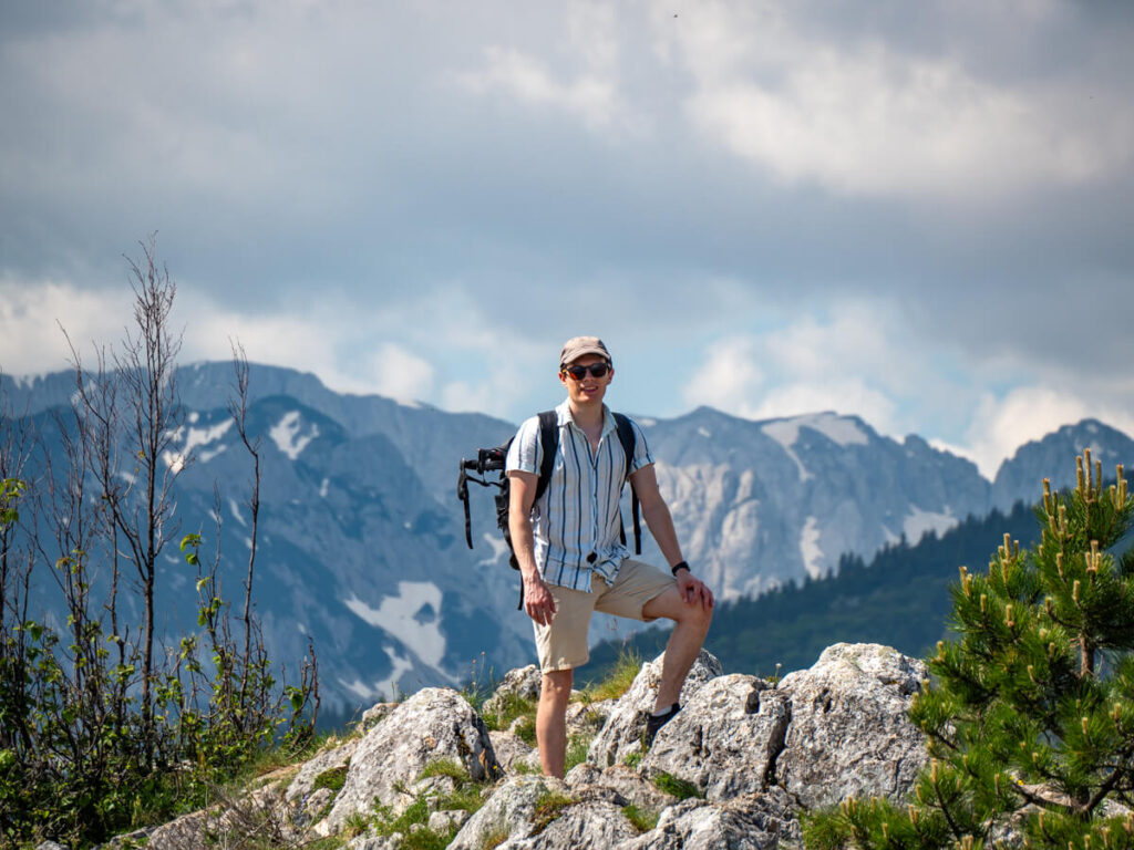
Jablan Lake (Jablansko Jezero) is one of Durmitor National Park’s quieter glacial lakes, tucked beneath the imposing cliffs of Crvena Greda. It was carved by glaciers during the last Ice Age. On calm days, its still surface reflects the surrounding peaks, while in early summer the meadows around the shoreline are dotted with wildflowers.
The hike to Jablan Lake is a great option if you’re looking for something beyond Durmitor’s most popular trails without committing to one of the park’s hardest summits. Although longer than the walk around the Black Lake, the route is still relatively gentle, passing through open pasture, forest, and beneath some of the massif’s most impressive cliffs. The trickiest parts are rocky paths and small elevation changes.
There are several other trails in this area, especially at the start of the trail. Even if you just go 5 minutes from the trailhead, you can reach an amazing viewpoint of the surrounding mountains and the Black Lake.
Longer routes
For something longer, you can continue on and hike Crvena Greda, which peaks at around 2,164 metres (7,100 ft). The name Crvena Greda translates roughly as “Red Ridge”, referring to the reddish tones visible in parts of the limestone rock. The route technically bypasses Jablan Lake, but it’s easy enough to detour to it, making for a nice place to stop on your way back.
Difficult Hikes in Durmitor National Park
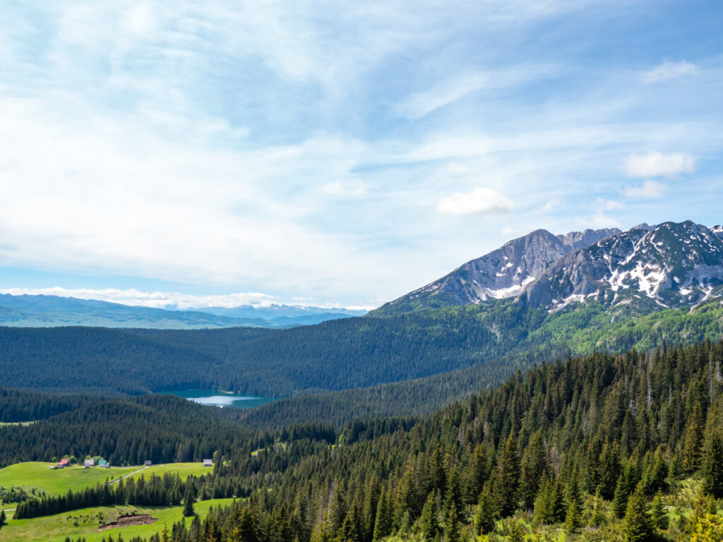
For experienced hikers looking to take things up a notch, there are several challenging hikes in Durmitor National Park. From steep summit climbs to serious routes in demanding alpine terrain, these hikes offer some of the park’s most rewarding views, but require good fitness, preparation, and mountain experience.

8. Sedlena Greda
Sedlena Greda is one of Durmitor’s most rewarding viewpoints, reaching 2,227 metres (7,306 ft) without the technical scrambling required on some of the park’s highest summits.
The trail begins at the Sedlo Pass, which sits at 1,907 metres (6,257 ft), making it a relatively short hike despite the impressive elevation. It’s opposite the main trailhead for the Bobotov Kuk hike.
The route climbs straight up onto a broad limestone ridge overlooking the Todorov Do Valley. The summit actually consists of two peaks, the southern of which is the highest. You don’t need to be an expert, but you need to be an experienced hiker for this hike – the southern ridge is jagged, with sheer, exposed cliffs on both sides, so be careful. The trail markers are also not as well established on this trail as on others.
From the summit, you’ll have uninterrupted views of the Škrka Valley and much of the central Durmitor massif. It’s a fantastic option if you want dramatic mountain scenery without tackling Bobotov Kuk itself.
9. Bobotov Kuk
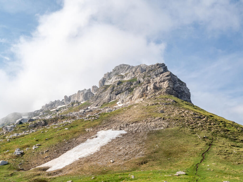
At 2,523 metres (8,278 ft), Bobotov Kuk is the highest peak entirely within Montenegro and one of the most popular hikes in Durmitor National Park. Although several routes lead to the top, the classic hike starts from Sedlo Pass and follows a rocky mountain trail before a final scramble to the top.
On the way, you’ll pass through lush valleys, below jagged limestone peaks, and to the shore of Zeleni Vir Lake, a stunning glacial lake at the foot of the ascent. To be honest, to this point, we’d call the route moderate.
On the summit ascent, you’ll see views over the beautiful Škrčko Lake before tackling the tough climb (aided by fixed steel cables) to the top. This is the challenging part that shouldn’t be attempted if you’re inexperienced or afraid of heights.
The summit sits on the watershed between the Tara and Piva river basins and delivers spectacular 360-degree views across Durmitor’s limestone peaks, glacial valleys, and neighbouring mountain ranges. While the climb isn’t technical, the exposed summit section and cable-assisted scramble mean it’s best suited to confident hikers with a head for heights.
Note: There’s also a second alternative trailhead, but this route is less commonly hiked than the one we’ve described. Parking for it can be found here: Parking Area II.
Longer routes
You can turn the Bobotov Kuk hike into a loop by connecting the summit with the second trailhead, but it does then require walking 2 miles (3.4 km) along the main road back to the main trailhead at Sedlo, unless you’ve arranged a vehicle at each end.
From Bobotov Kuk, you can also make your hike longer and continue onto the Ice Cave (Ledena Pećina) and the Black Lake. We’d recommend arranging transport, so it’s a one-way hike if you do this, or spend at least a night at either end. Alternatively, you could hike it the other way, from the Black Lake to Bobotov Kuk.
10. Prutaš
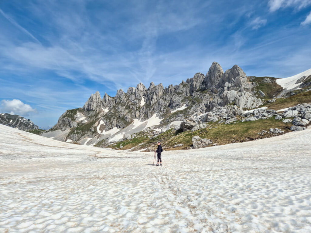
Often considered the most beautiful mountain in Durmitor, Prutaš rises to 2,393 metres (7,851 ft) and is famous for the distinctive horizontal bands that run across its south-west face. Its name comes from the Montenegrin word prut (“rod” or “twig”), a reference to these striking layers of limestone.
The hike from Dobri Do Valley climbs steadily through alpine pasture before ascending broad grassy slopes rather than loose scree or exposed ridges. The summit offers sweeping views across the Škrka valley, Bobotov Kuk, and the surrounding peaks, making it a favourite among many experienced hikers.
Note: There is a second trailhead for Prutaš in Todorov Do Valley, but it is much steeper and more challenging. You can park here: Parking Area II.
Longer routes
From Prutaš, you can continue through the Škrka Valley and onto the Škrčko Lake (the lake that’s visible from the ascent to the top of Bobotov Kuk). It’s also possible to combine it with Planinica.

11. The Ice Cave (Ledena Pećina)
Hidden beneath Obla Glava peak at around 2,160 metres (7,085 ft), the Ice Cave (Ledena Pećina) is one of Durmitor’s most fascinating natural attractions. Even during summer, the cave contains impressive ice formations, including stalagmites, stalactites, and frozen columns that persist thanks to the cave’s cold microclimate.
Unlike many ice caves that are formed inside glaciers, Ledena Pećina is a limestone cave. Its permanent ice exists because cold, dense air sinks into the cave and becomes trapped, creating a natural cold store that preserves snow and ice long after it has melted elsewhere on the mountain.
Many people start from the centre of Žabljak, but the easiest way to pick up the trail is to start west of the Campground at Ivan Do, which shaves a couple of miles off the round trip. Another popular alternative is to park at the Black Lake and pick up the trail from the Black Lake Loop.
The trail itself passes through forest into the mountains, before splitting into a loop. One of the trails passes Lokvice, where a small katun sells refreshing drinks. It’s impassable most of the year due to snow, so plan this hike for late July-early September if you’re keen to complete it.
Accessing the cave involves a steep descent into the entrance, so extra care is needed, particularly when the rocks are wet or icy. Even into June and July, it may not be possible to enter without picks.
Longer routes
The route can be done as an out-and-back hike, or descend into the Lokvice Valley to make it a lollipop loop.
From Ledena Pećina, you can continue onto peaks including Bobotov Kuk or Planinica.

12. Planinica
Planinica is one of Durmitor’s least-visited major peaks, making it a great choice for experienced hikers looking to escape the busier trails around Black Lake and Sedlo Pass. The route is long, physically demanding, and far less travelled than classics like Bobotov Kuk or Prutaš.
There are two main ways to reach Planinica. The most commonly used trailhead goes from the Black Lake, following the same trail as the Ice Cave (Ledena Pećina), before branching off. The alternative trail goes from the parking area for Barno Lake, passing near Zminje Lake.
The hike traverses steep limestone slopes, rocky terrain, and high mountain pasture before reaching the summit, where views extend across the southern Durmitor massif. Because of its length, route-finding requirements, and limited infrastructure, Planinica is best suited to confident hikers with good navigation skills.
Longer routes
From Planinica, you can continue onto Škrčko Lake in the Škrka Lakes Valley.
Honorable mentions
These are just a handful of epic hikes in Durmitor National Park. With more than 25 officially marked hiking trails covering around 93 miles (150 km), there are plenty of other routes to explore, and many can be linked together into longer day hikes or multi-day adventures depending on your fitness and experience. Other great options include:
Is hiking in Durmitor National Park difficult?
Durmitor National Park has hikes for almost every ability, from the easy circuit around Black Lake to demanding full-day mountain routes that climb above 2,500 metres (8,202 ft).
What’s really great about hiking in Durmitor National Park is that there’s plenty of flexibility too. Many routes share the same network of paths, making it easy to mix and match hikes, extend them into longer adventures, or turn back before the more challenging sections begin.
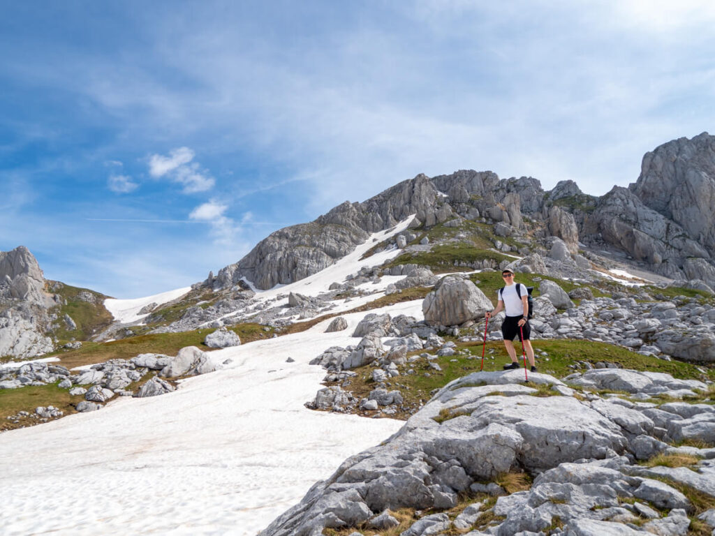
What catches many people out isn’t necessarily the distance, but the terrain. Even well-marked trails often involve loose limestone, steep ascents, uneven ground, and long, exposed sections above the tree line. Not to mention that some less popular hikes are just terribly marked to begin with. Weather can also change quickly at higher elevations, turning a straightforward hike into a much tougher day.
If you’re new to mountain hiking, we’d recommend starting with easier routes like Black Lake, Devil’s Lake, or Ćurevac before attempting peaks like Bobotov Kuk or Prutaš. We were glad to work up to the park’s more challenging routes after spending some time in Prokletije National Park and hiking the Three Peaks a few weeks before.
More experienced hikers will find plenty of challenging routes, but should still carry plenty of water, check the forecast, and allow more time than the trail distance alone might suggest.
Tips for hiking in Durmitor National Park
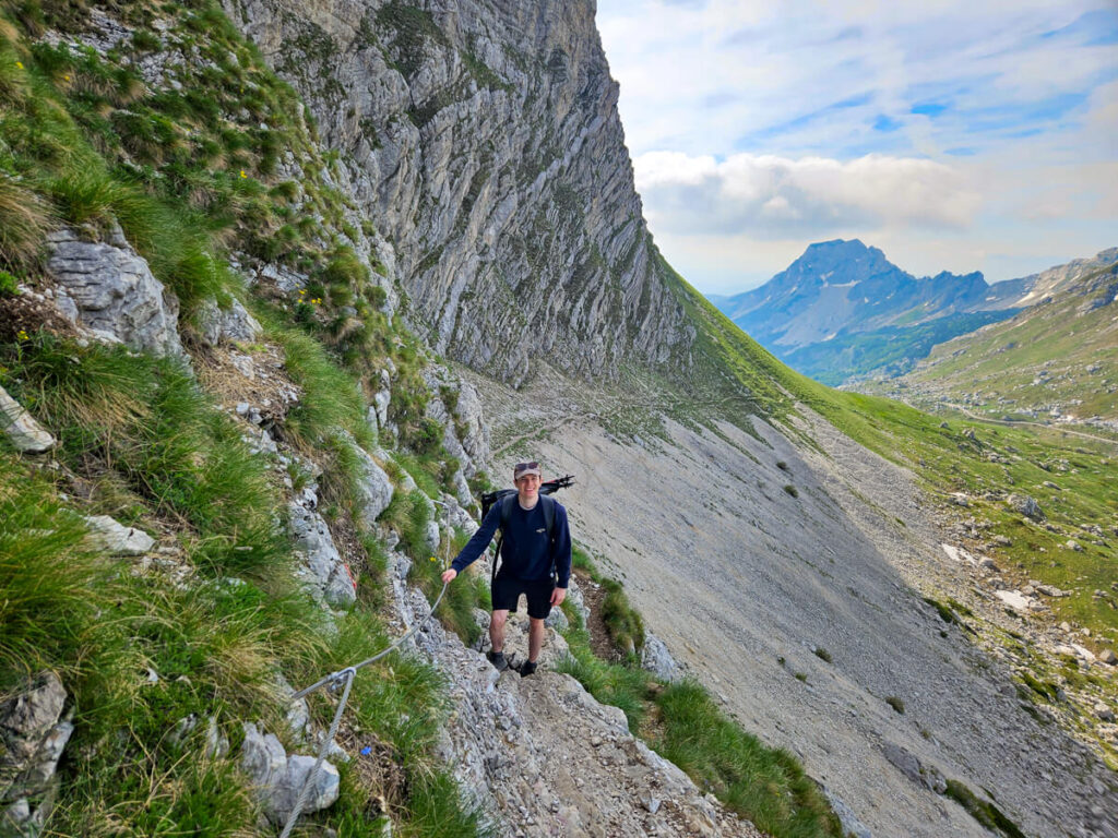
Durmitor is one of the most accessible national parks in Montenegro, but don’t mistake that for meaning every hike is easy. Many trails include serious elevation changes, where weather can change quickly, the terrain becomes rocky and exposed, and even relatively short distances can take longer than expected. A little preparation goes a long way, helping you stay safe and enjoy some of the country’s best hiking.
Hiking in Durmitor National Park FAQs
To help you decide which hiking trails in Durmitor National Park are for you, we’ve answered these frequently asked questions.
What are the best hikes in Durmitor National Park?
The best hikes in Durmitor National Park depend on what you’re looking for. Bobotov Kuk is the classic summit hike and was our favourite trail in the park, while Prutaš is often considered the park’s most beautiful peak. The Black Lake is perfect for a gentle walk, and Ćurevac Peak surprised us with one of the best viewpoints over the Tara River Canyon without a long climb.
Can you do self-guided hikes in Durmitor National Park?
Most self-guided hikes in Durmitor National Park are well marked with red-and-white trail markers, and many of the most popular routes are straightforward to follow with an offline map. Unless you’re attempting a particularly long or less-frequented route, most hikers won’t need a guide.
Are there easy hikes in Durmitor National Park?
Some of the best easy hikes in Durmitor National Park include the circular walk around Black Lake, the trail to Devil’s Lake, and the hike to Ćurevac Peak. These routes still showcase the park’s spectacular scenery without requiring advanced hiking experience.
Do you need a guide to hike in Durmitor National Park?
No, most visitors explore Durmitor National Park independently. However, hiring a local guide can be worthwhile if you’re tackling one of the more demanding trails, want to learn about the park’s geology and wildlife, or simply prefer hiking with someone who knows the mountains well.
What is the best time of year to hike in Durmitor National Park?
The main hiking season typically runs from late May or early June until October, depending on snowfall. July and August usually offer the most reliable conditions, while June and September are often quieter and cooler for longer hikes.
Is there an entrance fee for hiking in Durmitor National Park?
Yes, an entrance fee applies to Durmitor National Park, with tickets helping to fund the conservation and maintenance of this UNESCO World Heritage site. You can buy a ticket at the main entrances or from park rangers on some trails.
Read next:
A Handy Guide to Hiking in Montenegro & Our Top 10 Trails
All 5 Montenegro National Parks Compared + Our Favourites
An Ultimate Guide to Visiting Durmitor National Park
Where to Stay for Durmitor National Park: Cool Cabins + Top Hotels
15 Best Things to Do in Durmitor National Park + Our Itinerary
Driving the Durmitor Ring Road Route Guide
What It’s Really Like Hiking Bobotov Kuk
A Complete Guide to Hiking Ćurevac Peak
A Comprehensive Guide to Visiting the Black Lake
